Sunday, August 26, 2012

Durango, Los Pinos, & Horse Pucky

Changing Colors
Although it is just the last week in August, autumn is slowly coming to the high country.  Low bushes and grasses have already begun their inexorable descent into winter hibernation.  Even some of the lofty aspen near timberline have shifted a shade or two.  Certainly, days are getting a little shorter and night-time temperatures are slipping lower.  Soon the forests here will be a riot of color: orange, yellow, and many shades of red.  Aspen, nearly everyone’s favorite in this part of the country, will exhibit all of those ranges of color once they reach their full bloom.  Additionally, the small rodents display behavior foreshadowing the coming of fall.  The chipmunks and squirrels while normally…well… squirrelly, are nearly frantically scurrying around making last minute collections for their winter caches.

We will soon be leaving Colorado for New Mexico and then back home to Texas.  We have begun squeezing in as many outings as possible since our time is so short.  On Friday, we took a day trip into Durango, fred’s boyhood home.  The town has grown significantly (some 16+%) in the last decade and now is close to 17,000.  Of course, the county is much larger at 52,000+--Colorado’s fifteenth most populated county.  Growth equals change and Durango has changed significantly.  Mostly, it has become a mecca for touristas and rich folks who want a piece of the mountains all to themselves.  People always scoff when I say that, but a quick perusal of Durango’s multi-list will show most houses around a half million or more in a very down real estate market.  Our home in Texas would cost more than twice what it is worth (not necessarily what we would get in the present market) in Durango and would have none of the amenities.
In any event, we walked Main Avenue which on Monday hosted Stage I of the USA Pro Challenge bicycle race.  By the way, the final stage of that race will be in Denver today (Sunday).  Main is loaded with the usual tourista curio and T-shirt shops.  There are lots of places selling turquoise jewelry, ostensibly made by Native Americans.  Of course, the suburbs have all of the big box stores where you can by the stuff you really need.  We had an excellent lunch at Carvers Brewery, one of the many such establishments occupying downtown.
Los Pinos River is one of the drainages that supplies Vallecito Reservoir.  It also has a great trail that follows it north into the Weminuche Wilderness area.  Saturday found us making our way up that gorgeous valley for a pleasant day hike.  Well, it would have been more pleasant had it not been a favorite for day tripping equestrians and overnight back-packing and horse-pack trips.  We used to describe motorcycling as a olfactory experience because you are in the open air and smell everything that has an odor anywhere near your ride.  This hike was an olfactory experience, too.  It was mostly like what we imagine living in a stable must be like before you become accustomed to the aroma of hot horse pucky and sweaty livestock.
Los Pinos Trailhead
View Rom the Trail

At the Wilderness Boundry
Los Pinos River

Aside from the fragrance of the trail, the forest was absolutely stunning.  It was an easy trail without the normal high elevation gain one usually finds on these hikes.  The Los Pinos River is a beauty and it is still carrying quite a bit of water for this time of year.  On a Saturday, it should have been crawling with anglers, but we only saw two on our entire hike.  There is high moisture along the trail and in the surrounding forest due to heavy winter snows resulting in a wide variety of fungi.  They come in many shapes and sizes; and, presumably, lethality.  The first few miles of the trail borders a ranch called Granite Peaks Ranch.  This is a very beautiful 565-acre ranch that has three miles of the Los Pinos running through it and the setting is to die for.  Curiosity, being what it is, took us to Google and a quick search showed that the ranch in its entirety is for sale for a mere $24,000,000.  Wrap it up, Jack; I want that place.
Part of Granite Peaks Ranch from the Trail
Fungi


Mas Fungi


Thursday, August 23, 2012

Holy Merde, What Was That?

Today we took the day off to enjoy some down time in-as-much as the forecast called for heavy rain, thunderstorms, and possible flash flooding.  No fun being on hiking and 4 X 4 trails in a downpour.  We figured the forecasters managed to get it wrong again when the day dawned sunny and warm…well, warm for Vallecito.  We took a three mile walk up to the national forest campground and back to get the blood flowing.

After lunch we settled in with reasonably good books and were planning to waste the day away.  The rain began around 3:00 p.m., gentle at first and then a genuine gully washer, or as we call them in Texas, a frog strangler.  The rain continued for a time and the thunder and lightning increased significantly.  Around 3:30 we decided to preheat the oven for an early dinner when not 30 yards away, lightning struck a huge (40-50 ft. tall) Ponderosa pine tree.  We have never been so close to a strike before.  The ball of fire was huge and the noise so loud it reminded us of canon fire.  Almost instantaneously, debris began raining down on our motorhome.  Our first reaction was that we were the ones struck by lightning.  Fortunately for us, it struck the tree described above.  That tree promptly fell on a small trailer.  Oh, merde, we thought, there are people in that trailer…older than us people.

In spite of the rain and the risk of additional lightning, we grabbed raincoats and ran to the trailer to see if they were okay.  I crawled under the downed awning and found a window and yelled to see if everyone was okay.  It turned out that they were unharmed, but the tree had pinned their door closed so that they couldn’t get out.  The wife said that she could smell smoke and thought the trailer was on fire.  I told her I would check by walking around the trailer.  All I found was a burned electrical cord that had been out for their outdoor lighting…that was probably what she smelled; that or burned ozone from the lightning strike.  Interestingly, the lightning didn’t burn the tree at all—just turned it into firewood.  Just after I determined that they were okay, employees and other people from the park began to arrive,  and we determined that we needed a chainsaw and the park’s tractor to help remove the tree so the couple could get out of their trailer; it was way too big to move by hand.

The chainsaw and tractor arrived pretty quickly.  Work commenced and we had the tree removed in pretty short order.  Once extracted from the trailer, Susan took the wife to our rig where it was warm, dry, and safe from falling debris.  Within an hour and a half their entire site had been cleaned up and all of the tree branches, etc., were hauled off.  Park employees also picked up all of the debris (think kindling) from all of the nearby sites, including our own.  The only damage was to the trailer’s awning; it literally absorbed almost all of the weight of the tree.  Of course, it was ravaged beyond salvage, but probably saved the trailer itself from serious damage--as in being crushed like an empty beer can.   Susan and I are going to apply for Colorado’s official rescue ticket so we can do this legitimately.


Wednesday, August 22, 2012

Fire, Rain, & Old Mountain Towns

In the previous blog posting, we mentioned the Missionary Ridge fire that occurred in 2002 near Durango in southwestern Colorado.  Recently, we learned that the statistics we quoted were wrong.  We have since verified that the data we used was erroneous and is corrected here.  The MR fire, which ran from June 9 through July 28, burned more than 70,000 acres at a cost of about $41 million.  The Vallecito Valley, where we are currently staying, was hit particularly hard during the fire losing 28 of the 58 houses that were burned.  A tribute to the firefighters and others was the commissioning of a series of wood carvings by a local wood carver depicting actual scenes from the fire.  The result is 15 carvings (standing about 18’ tall and weighing some 2,600 lbs.) that have been placed at various places around Vallecito Reservoir—usually where the sponsors do business or live.  We took the Tour of Carvings and enjoyed the rustic artwork one day while exploring the area around the lake.

Missionary Ridge Fire Remains
Tour of Carvings
Tour of Carvings
Tour of Carvings

We’ve been dodging afternoon rains most days, but have managed to get out and about some, including a drive up Middle Mountain Road and then a hike from the old ghost town of Tuckerville to a beautiful overlook some three miles from the town site.  The forested region we passed through was notable because of the large number of huge trees that had been unceremoniously snapped off in the violent winter storms that frequent this place.   The “trail” was a closed 4 X 4 road that was almost vertical having been used for mining operations in the 1920s.  The road ended at the Weminuche Wilderness boundary.  There was just a very short hike to the overlook.  Unfortunately, as you will see below, the view was less than spectacular as afternoon clouds and rain had set in obscuring what undoubtedly would have been stunning views of the San Juans.  On the bright side, we were able to field test our ponchos once again…actually, we are getting close to wearing them out.
View from Middle Mountain Road to the West
 
A couple of drowned rats!
Bully Bully -- Our only "wildlife" on this outing
Tree broken by winter storm


When we drove to Vallecito from Montrose last week we stopped in Silverton, but couldn’t find a good place to park our motorhome.  We promised ourselves we would return someday for a good look around.  Well, that day was yesterday.  Although it was cool (we had an overnight low of 40°), the skies were clear and it looked like a great day for a road trip.  We had a pretty good look around town (meaning we darkened the doorstep of almost every store), enjoyed a fairly good lunch, and acquired the obligatory T-shirt before working our way back to Vallecito.  The Durango & Silverton Narrow Gauge Railroad is still running two trains a day and so town was packed with touristas.  Apparently, the train runs three times a day in peak season, but students have resumed classes so they’ve cut back to two.  We had planned to take a four wheel drive road for part of the return, but a mile into it the road was closed for repairs.  It seemed kinda odd to us as 4 X 4 roads by definition need repair or they would be autobahns.  Oh, well.

Silverton from Molas Pass


Downtown Silverton


Durango & Silverton Railroad


Friday, August 17, 2012

Weminuche...both sides now!

Wednesday morning (August 15th) dawned without a cloud in the sky…a perfect day to travel from Montrose through Ouray and Silverton to Vallecito Reservoir via Red Mountain Pass (11,018’)—the Million Dollar Highway.  Not!  The sky, although cloudless, was milky white with smoke from fires upwind in Washington state.  We have made the trip often, but were still disappointed that the spectacular views would be obscured by smoke.


San Juan Mtns from just north of Ouray


San Juan Mtns closer to Ouray
Many RVers refuse to drive Red Mountain Pass because of its narrowness, tight curves, and steep drop-offs…oh, yeah, the lack of guardrails really spooks them.This has never bothered our driver as he remembers riding over the pass many times in the winter during the late 1940s when the byway was a very nasty gravel road.The original part of the highway was a toll road built in 1883 by Otto Mears and used to haul ore and supplies before the railroads were constructed.In 1926, it became part of the federal highway system.

North side of Red Mountain Pass


That sucker looks pretty deep!
Avalanch Shed
South side of Red Mountain Pass

Red Mountain on left
Taking a break on Coal Bank Pass
We had a largely uneventful ride over the passes (we also traversed Molas--10,666’--and Coal Bank Hill--10,910’ Passes).  We had two pretty scary deer events; the first near Ridgeway and the second on the Durango side of Coal Bank Hill.  On both occasions, we had mule deer does within very few feet of becoming road-kill under our motorhome.  Quick thinking brought the air horns on the rig to bear and in both cases the does skittered away in the opposite direction.  Needless to say we were both experiencing serious adrenalin rushes afterward.
Our location for the next two weeks is at Vallecito Reservoir some 22 miles northeast of Durango.  Our RV park is one mile from the Weminuche Wilderness boundary…many miles south of where we were hiking near Creede, but a hardy soul, with time on his or her hands, could make the several day trek north and come out at 30 Mile Campground where we began our Squaw Creek Trail hike.  If you have a faulty memory, or perhaps it has all run together for you, refer to our earlier blogs from Creede.
Since the Weminuche is so close and because we could hear it whispering our names, our first outing here was on the Vallecito Creek Trail.  This seven-mile round trip was delightful.  Generally a fairly gradual climb, it follows the creek into the wilderness for more miles than we would care to hike, but every step is beautiful.  The creek, fed by many streams and drainages, is still running quite full for this time of year.  It certainly deserves a name conveying something larger than a creek.  But there it is.  It’s a popular trail and even on a Thursday there was lots of traffic…not as bad as the Alpine Loop thankfully, but we didn’t have it to ourselves either.  The upper parts of the trail show the damage from the 2002 Missionary Ridge Fire that burned 137,760 acres, displaced 5,340 people and destroyed 133 homes…a nasty bit of work.
On Vallecito Creek Trail

Vallecito Creek
Hi, sweetheart!

Vallecito Creek

Tuesday, August 14, 2012

Yankee Boy & Last Dollar


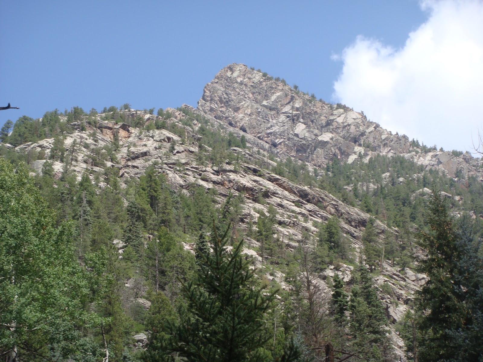
The San Juan Mountains near Ouray, Colorado, are often referred to as the “American Alps.”  The peaks here are absolutely soaring.  One of the best places to see them is in Yankee Boy Basin.  The four-wheel drive road starts out easy (one of the reasons there is a lot of tourista traffic), but gradually gets more difficult as it approaches 12,000’.  In the same general area, and accessible from the same road, are Governor and Sydney Basins.  Imogene Pass, a 13,000’+ pass that goes from Yankee Boy Basin to Telluride, is also a popular trip from this same road.  In addition to driving Yankee Boy Basin, we drove up Governor Basin to its end, but time and the threat of storms again forced us down before we could access the other side trips.

The start up Yankee Boy Basin
An interesting stretch of the road in YYB
An abandoned mine in YYB
Near the top of YYB
Governor Basin Road
Near the top of Governor Basin

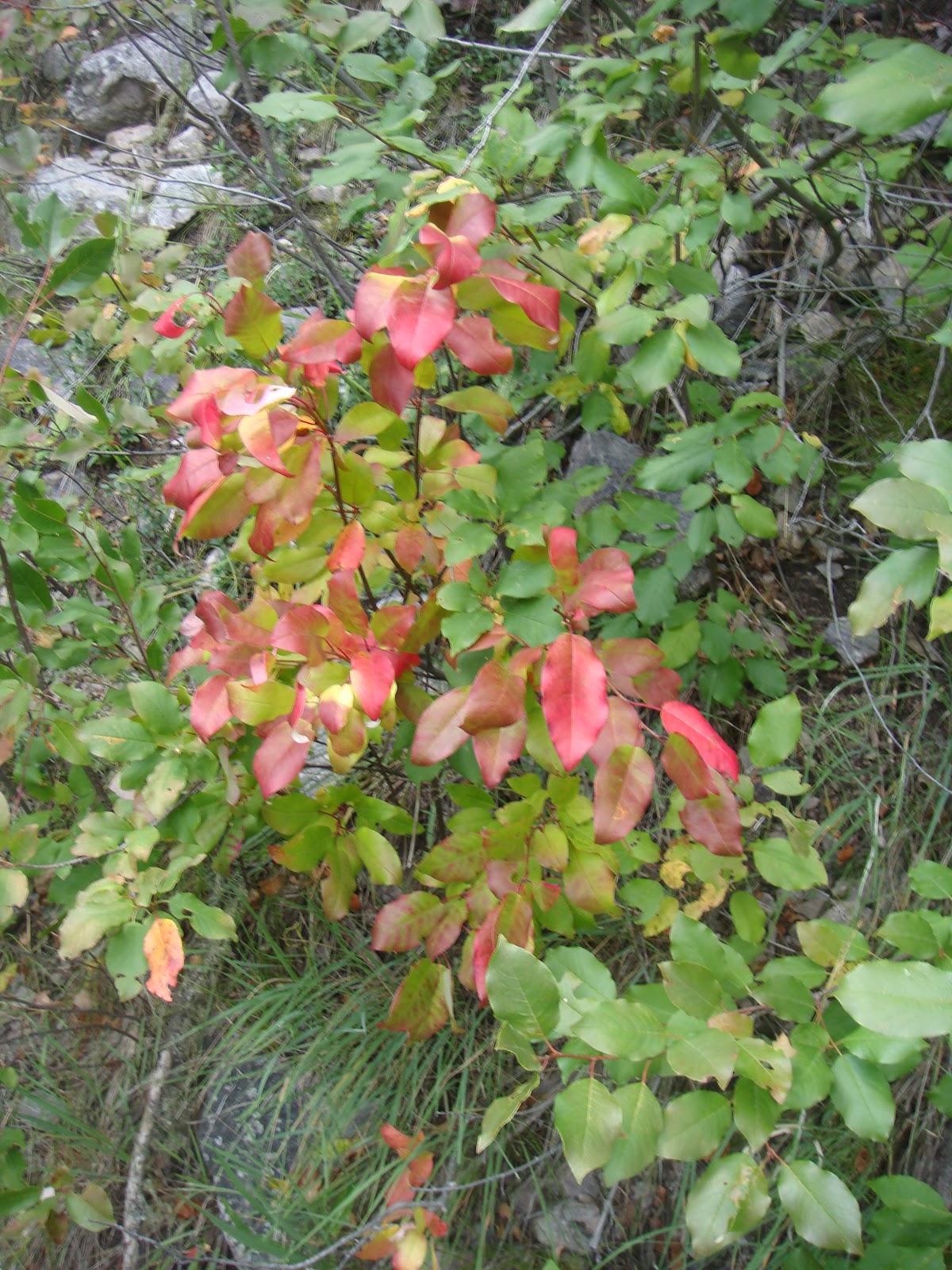
Among the more interesting things about this region is the fact that many of the mines are operating again. Remember that most of these mines date from the mid-1870s and 1880s. The road had lots of mine traffic, including a large load of pipe and a tractor dragging a large container that we had to follow up part of the trip.  We didn’t catch up to the container until we got on the Governor Basin road and had to follow it all the way to the mine at the end of the very narrow road—above 12,000 feet.  Mines have reopened because the price of commodities is such that they can once again make a profit, even with the high costs of extraction.  We were surprised to learn that platinum has been found in many of these defunct gold and silver mines in addition to the other precious metals.

A load of pipe (front vehicle) makes its way up YYB
A container being drug up Governor Basin road
Modern day mine tailings in YYB

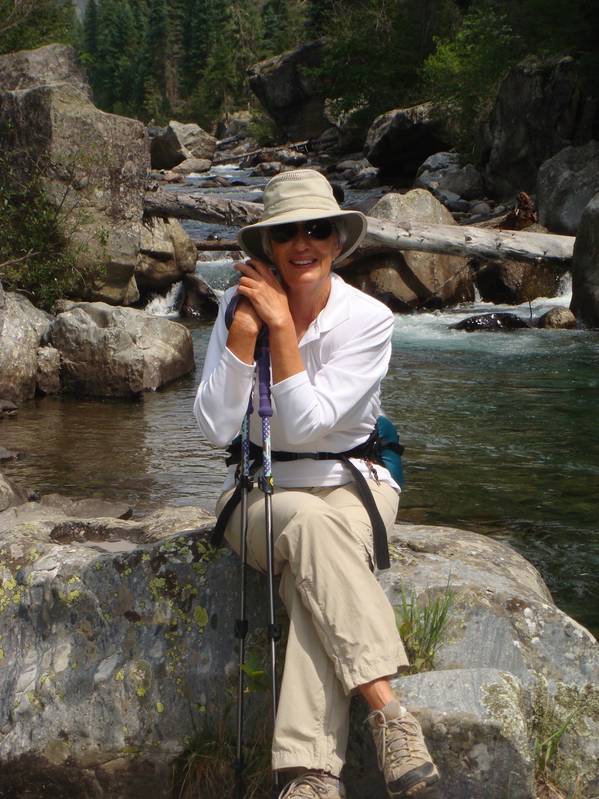
We are always drawn back to Telluride any time we are in this area and this trip was no exception.  Many of our favorite hikes are in the Dallas Divide area near Ouray, Ridgeway, and Telluride…now many of our favorite four-wheel drive trails/roads are also in this region.  Our most recent adventure was taking Last Dollar Road from the Dallas Divide to Telluride.  As far as four-wheel drive roads go, this one is a bit of a drive in the park, but the beauty one encounters is well worth the low difficulty rating of the track.  Often, we spend most of our time above timberline when we go off roading, but Last Dollar Road was mostly in aspen and pine forests in addition to traversing beautiful high-country ranches.
 Aspen forest on Last Dollar Road
A mixed pine forest on Last Dollar Road
Scenic view from Last Dollar Road
Mount Wilson 14,252' 

 Beautiful downtown Telluride
On the Telluride side of the pass the road passes through a vast hillside of upper 1% holiday homes, whether used for skiing or summer respites.  It is clearly and eye-opener…the rich truly do live different lives than the rest of us.  There will be no photos of these palaces as you all know what they look like.

The elusive elk finally showed up a mile or two outside of Telluride in a rancher’s pasture.  It was a sizeable herd containing young bulls, cows, and calves.  There was one slightly older bull in the herd, but it was difficult to determine if he was the herd’s leader.  In any event, we captured their images for you.
The big guy in tghe center may be herd's leader

More Elk