Thursday, July 26, 2012

Mark Twain, Snow Mesa, & Rodents for Lunch


Mark Twain has always been one of our favorite authors.  The Creede Repertory Theatre, which we have mentioned earlier in this blog, is producing Is He Dead?, a play that he wrote in Europe in the late 1890s.  It was never performed until just recently.  It’s ironic that perhaps his funniest play took 100 years to be produced.  We attended CRT’s earlier production of Mrs. Manners, which we thoroughly enjoyed.  Although we expected a good show Tuesday night, we were blown away!  We were members of the Denver Center Theatre Company for many years when we lived in Denver, yet we have never seen a better performance than the one we saw Tuesday night.  It was so funny our faces hurt from laughing.  We aren’t amused by trifles.  When we exited the theatre, the entire cast was lined up out on the sidewalk to greet the audience.  What a top notch finish to a really fun evening of entertainment.  CRT is taking Is He Dead? on the road to the Arvada Center in October.  If you live on the Front Range of Colorado, you should make this play a priority—we promise that you will be thoroughly entertained and will have one of the best laughs you have had in a long time.

Most of the hiking trails in this region are nearly vertical.  Wednesday’s outing was no exception.  We like the Colorado Trail and the Continental Divide Trail, and here they are combined for long stretches.  We decided to resume our exploration of the east side of Spring Creek Pass with a trek up to Snow Mesa (we blogged earlier about our experiences on San Luis Pass several miles east of this hike).  Spring Creek Pass is about 10,900’ and Snow Mesa is about 12,300’+/-; that’s approximately 1,400’ over two or so miles.  Going up was a grind as the trail never leveled off for a breather or a stop for morning tea for the first mile and a half.  The most interesting thing about the hike up other than the views was the prevalence of exceeding large cairns.  They are usually just small piles of rocks used to mark a faint trail, but these babies were huge.  Above timberline, the trail entered and followed a large talus slope all the way to the top of Snow Mesa.  Actually it was more of a talus mountain than a slope.
A Very Large Cairn
A Mega Cairn 
Talus Slope Trail
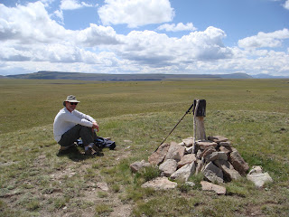
However, once we were clear of the tree line, the views to the west and northwest were spectacular.  On top of Snow Mesa, where tundra prevails, we had 360° views of the San Juan Mountains and the  Weminuche, La Garita, and the Uncompahgre Wilderness areas, including the previously blogged about Alpine Loop.  We could easily see a cluster of five fourteeners: Uncompahgre Peak, Wetterhorn Mtn., Handies Peak, Redcloud Peak, and Sunshine Peak to the west and one, San Luis Peak, to the east.  In every direction there were more thirteeners than you could count or name.  Had the wind not been so vigorous and cold on Snow Mesa, we could have stayed up there for hours just soaking in the views.  Instead, we retreated downhill for lunch among the rocks only to be scolded by pikas, marmots, and other rodent denizens of the talus region.
Uncompahgre Peak & Wetterhorn Mtn
On Top of Snow Mesa
Downward Bound
Our trip down was largely uneventful except for being caught and passed by four young backpackers.  The first two caught up with us just after we finished lunch when we were almost back to the tree line.  They were descending rapidly and clearly had more confidence in their ankle strength on the rocky trail than we did.  Several minutes later a third young man passed us; he was going slower than his companions and took the time to wish us a great day.  Nearly ten minutes later the final person in that group arrived.  He was much slower than the others, yet laughed about it when we teased him about being a slowpoke.  It turned out that they were hiking all the way from west of Denver to Durango on the Colorado Trail and had been out 21 days.  He said the other fellows were just 16 & 17, and as the old man at 21, he had a hard time keeping up with them, especially going downhill—that was a true statement as we had seen them together as they started down from Snow Mesa.  Imagine being the “old man” at 21.  Biologically, we could easily have been their grandparents:  Makes one feel pretty good to be joining them out on the trail—even if it were for just a day at a time rather than weeks at a time.
Our View from our Lunch Stop

Sunday, July 22, 2012

Mountain Byways & Volcanic Debris

Prior to the mid-nineteenth century’s massive expression of Manifest Destiny and the mineral extraction craze that plagued the western United States, the Ute Indians occupied all of what is now Colorado and spilled over into Wyoming, New Mexico, and Utah.  The people of the Shining Mountains (as they called the Rockies) were a semi-nomadic people who were content to live off the land and own none of it.  Mountain men and other intrepid explorers had made forays into the Colorado Rockies prior to the Civil War, but the biggest push began shortly after its end.  The devastation in much of the South and other regions of the newly-reconstructed country helped encourage a large migration of people west.  They all weren’t sod-busters in Conestoga wagons; the most aggressive were the mineral extractors.   A number of gold strikes in southwestern Colorado created a frenzy of activity.  Prospectors crawled over the high mountain passes that previously served the Utes as passages from winter to summer hunting and living areas.  When strikes were made, the prospectors widened the old Indian trails to handle wagons to carry ore and, later, built toll roads and railroads for the same purpose.
American Basin
The Rockies are riddled with these old routes.  Most have been long abandoned; others thrive as playgrounds for Jeepers and ATV enthusiasts.  Where we are located, near the heart of major mineral finds, there are countless four wheel roads (that’s a fairly generous description of many of these routes) that can be used to penetrate the highest reaches of the San Juan Mountains.  One such is the 50-mile Alpine Loop Backcountry Byway.  This is a series of roads cobbled together to form a loop, but initially the roads were used for the transport of ore from mines located in remote recesses of the mountains to transportation hubs located elsewhere.
The Alpine Loop begins and ends in Lake City.  There are lots of options for the four wheeler besides completing the loop.  Among them are side trips to both Silverton and Ouray over different routes; however, your travelers chose to take the loop in its entirety.  Our friends from Buena Vista, Ed & Jeri, joined us for a couple of days, and the trip on the Alpine Loop was the highlight of that visit.
Near the top of Cinnamon Pass
One cannot begin to describe the beauty of the backcountry in this part of the state. There are high mountain vistas with fields of wildflowers.  On clear days the views are more than spectacular—we had such a day.  The road itself is interesting in that one can take a two wheel drive street car on portions (we saw a BMW sedan at one of the trailheads) of the road and other sections require four wheel drive vehicles because of the steepness and the necessity for high clearance.    The Byway climbs from an altitude of 8,761 feet (that’s 2,640 meters for our Commonwealth friends) at Lake City to over 12,800 feet at Engineer Pass.  One actually must pass over Cinnamon Pass at 12,600+ feet and then descend to Animas Fork before climbing again to Engineer.  From the Loop, energetic folks can access trails that will take them to five fourteeners and more than a half dozen thirteeners.  Much of the Loop is located in BLM land, but is surrounded by Weminuche and Uncompahgre Wilderness areas.
View NE from Cinnamon Pass
A Cluster of 14ers
On the return to Lake City from Engineer Pass we were treated to the sighting of a black bear.  He was on the other side of Henson’s Creek from the road.  He was very large and very perplexed.  It seemed clear to us that what he really wanted to do was cross the creek and then the road and continue on his merry way.  However, because there were several of us parked and taking pictures of him and gawking at him through binoculars, he wasn’t about to make any attempt to proceed.
One cannot put too fine of point on the beauty one encounters on the Loop.  However, we were equally stunned by the mass of humanity that converged on the Loop on the day of our visit.  There were all manner of ATVs and nearly every brand of four wheel drive vehicle made in the U.S.  The ATVs tend to swarm together like angry wasps—they actually sound like a swarm of angry wasps, too.  In our humble opinions, they are the scourge of the earth.  Some folks probably feel that way about all motorized vehicles, but not us, we are Jeepers.  To illustrate the crowd, on one particularly nasty part of the four wheel drive road up to Cinnamon Pass, we met a line of Jeeps.  A fellow from Texas in front of the group quipped, “Traffic’s worse than Houston.”  That pretty well summed it up.
Masses of humanity notwithstanding, we thoroughly enjoy our outing and we managed to get out of the mountains before the afternoon rains hit.  There would be the danger of lightning strikes above timberline as well as incredibly slick roads had we be caught up there in a thunder storm.  We did get the dust washed off the Jeep on the ride home, which was nice.
Views from Engineer Pass


Having not exceeded our capacity for four wheeling, we set off on Friday to explore the Wheeler Geologic Area.  Unlike the Alpine Loop, this trip we encountered no other traffic on the way up and only a couple on the return trip.  This 640 acre area was once a National Monument under Teddy Roosevelt’s administration, but because of its remote location and difficult access, it was transferred back to the Forest Service and in the 1950s was designated a National Geologic Area.  In the early 1990s it was added to the La Garita Wilderness.

Twenty odd million years ago this entire region was an active volcano and the resulting caldera was the product of an explosion that was 5,000 times as strong as Mt. Saint Helens (no, that is not a typo).  The rocks that comprise the geologic landscape of Wheeler consist of coarse volcanic tuff.  The debris that formed this tuff was blown into the air from volcanic vents and settled in this place.  Over millennia, wind and water eroded the rock into the existing spires and pinnacles.  At some point in the future the area will be eroded completely away.
All the published guides indicate that the Jeep trip into the area requires a commitment of about 10 hours due to the difficulty and roughness of the 15 mile road.  Undaunted, we started off on the four wheel drive road.  Three hours later, after passing through a variety of sub-alpine terrain and driving on one of the roughest roads we have ever been on, we arrived at the end of the road.  From there it was supposed to be a half mile hike.  It was at least twice that and then we decided to explore the Wheeler Loop Trail, which took a couple of more hours.
As with the Alpine Loop road, words to describe these stunning, picturesque features are hard to find.  After arriving at the end of the road, we hiked into the lower access trail where we got an up close and personal look.  It is amazing to see how the elements have worked the rock to create the unique characteristics.  Later, we backtracked from the base so we could have a view from a higher vantage point.  We weren’t disappointed…it was truly mind-blowing.  While there, we met local artist Stephen Quiller, who has an art studio in Creede.  He was very friendly and tolerated our interruption of his work for a few minutes and graciously allowed us to take a couple of photos of him at work.
Stephen Quiller
After our seventh hour on this trip, we were finally ready to depart for home.  We knew we probably had at least a three hour drive to get off the four wheel drive road.  Not long after our first hour on the road out, we encountered some ATVers who looked like they were having trouble with one of their vehicles.  Since we were the last ones out (it was about 5:30 p.m.), we stopped and asked if they needed assistance.  They were thrilled.  It was decided that we would take half of the six person group with us and the others (two men and a young boy) would attempt to tow the broken down vehicle back to the staging area.  Hence, we wound up with three generations of women: grandmother, mother, and daughter; Texans all.  It seems to be our week to pick up and rescue strays.
Our Rescuees, Safe and Sound

Monday, July 16, 2012

Mountain Marathon & Wedded Bliss

Like many RV parks we have stayed in over the years, this one has a group of people who go on organized hikes together regularly.  We decided to join this group for a hike this week because it’s a great way to meet like-minded folks.  It’s not perfect, but it seems to work well most of the time.  Anyway, we went with the group on Thursday to Ivy Creek Trail for what was to be a 5-9 mile hike depending on one’s stamina.  We had 21 brave souls show up at 8:30 am for a nose count and to decide how to carpool.  We joined a couple who are part of the “leadership team” for these hikes (We had met the man when we visited their coach to get information about the hike).  John was initially stand offish, but warmed up as soon as he determined that we were serious hikers and not just slugs looking for a way to kill some time.
The leader of the group is an ex-Brit and an ex-military officer who has the demeanor of both.  He indicated that we divide the large group into two since only 15 people can hike in the wilderness in one clump.  There would be one group that would do a 5 mile round trip hike and a second, who would do a 9 mile round trip hike and we could self-select.  Initially, we decided to go with the shorter hike group as we haven’t acclimated to longer hikes yet.  However, the numbers were lopsided and we were recruited to go with the longer hike group.
It turns out that Tristan and his self-selected group (not necessarily including us) were trail warriors whose goal was to cover as much ground as fast as they could in the shortest amount of time.  Well, that didn’t settle too well with us as we like to take lots of photos, gawk at the scenery, and stop to rest and have morning tea about an hour or so into a hike regardless how long it is.  We actually had no difficulty keeping up with the group, but after the first hour we could see that they were not into enjoying nature per se, but wanted to simply make tracks.  Hence, we stopped and told them that we would keep going in their general direction (one of them was our ride home after all), but that we were going to stop for morning tea and we resume our hike in 15 or 20 minutes.  They went on; we had Frappuccinos and scones on a fairly comfortable log and enjoyed the sound of Ivy Creek flowing near-by.
Speed Daemons
We commenced our hike well rested and sated.  After another hour and a half decided that it would be a bummer to have these racehorses get to their destination, eat lunch, and then return down the trail meeting us who hadn’t had lunch.  We are food aficionados on the trail, so we stopped at a convenient spot with the idea that we would eat and then continue up the trail.  We took a half hour for lunch and just as we were packing up to continue, who shows up but the slow group.  They hadn’t stopped at 2.5 miles, but had continued to where we were at about 3.5 miles.  Apparently, they hadn’t stopped to rest or take morning tea either.  Oh, well.  After kibitzing with them for a time, we set off to continue our hike.  We didn’t get to the next turn the trail before the other group arrived fresh from their lunch break.  We decided to join them for the trip down and managed to keep up with them quite nicely.  In retrospect, we met some interesting people, some of whom we actually like, but we don’t know if we will be going on a group hike with them anytime soon.  We much prefer to leave when we want to leave, go where we want to go, and to do it at our own pace.  Stay tuned.
Slow Group Joins Us For Lunch
Our 29th wedding anniversary was Saturday and we celebrated with a fantastic dinner at the Antlers Lodge, which is located right on the Rio Grande.  It was a dark and stormy evening, but our outdoor venue was protected with shade cloth and clear plastic sheeting.  We had a great meal and were serenaded by the young and attentive wait staff after receiving our dessert.  This not anything we invited, but once they learned we were celebrating, there was no stopping them.  We got a nice round of applause from the other diners…maybe that was for the serenade.
It Doesn't Feel Like Its Been 29 Years!

Wednesday, July 11, 2012

Cannibals, Moose, & other Mountain Critters

The Creede Repertory Theatre (CRT) has been producing fine theatrical presentations for 47 seasons, and it has a national reputation for excellence.  We couldn’t let something like that be available and not take advantage of it.  We attended the play, Mrs. Mannerly, by Jeffery Archer, the other evening in the CRT’s new theatre in the round…well, it’s actually a U, but who’s complaining?  Anyway, we thoroughly enjoyed ourselves and plan to attend another performance (Is He Dead?, a play by Mark Twain) later in the month.  It will be in CRT’s old, auditorium style theatre, so making the comparison between the two venues will be fun.

Our weather continues to be mostly rainy and cool (low 70s during the day and mid 50s overnight), but we have managed a few short road trips in the Jeep including a ride over to Lake City on Monday (7/9).  The scenery was pretty spectacular with great views of several “fourteeners” in this part of the San Juan Mountains.  The road to Lake City traverses a couple of passes, one of which is Slumgullion Pass.  It is named after an 850-year old earthflow that dammed up the Lake Fork of the Gunnison River to create Lake San Cristobal, the second largest natural lake in Colorado.   This slump is still active, moving at the rate of about 20-30 feet per year.
Uncompahgre Peak @ 14,321', Colo's 6th Highest
Lake San Cristobal, Colo's 2nd largest natural lake
Lake City is smaller than Creede, although if the two were combined they still wouldn’t make too much of a town.  We spent some time traipsing through the shops and since fred was behind in the tourista junk purchasing category, he found a lovely hat (picture an old Indiana Jones) to keep the sun off of his recently sensitive head.  We took the time to visit the site of the Alferd Packer Massacre, which is the location of the cannibalization of five people in 1874 by Packer.  The quote on the memorial says, “You man eating son of a….  There was seven Democrats in Hinsdale County and you ate five of them.”
Alferd Packer Massacre Site
If you have been paying attention to this blog, you know that this region has received over the past couple of decades a transplantation of moose.  You also know that we have been searching for same.  A fellow in a sporting goods store in Lake City told us about an area where moose had been spotted over the past several days.  We couldn’t let that pass, so, after lunch, we headed off in search of the elusive moose.  Fortunately, the road we needed to take was on our way home, so that made the side trip closer to our RV resort as well as pleasant.  We followed a willow-infested drainage (moose’s favorite habitat) for 7 or 8 miles before deciding to return to US 149 the same way we had come.  About half way back to the highway, we encountered a couple of pickup trucks parked on the road and people (men, women, and children) milling around.  We thought there might be some problem, or, perhaps some kind of wildlife.  Since they were Texans too (We did tell you that most of Texas is in this part Colorado this summer, didn’t we?), we stopped to see what was going on.  Lo and behold, out in the middle of a small pond stood a bull moose.  He was feeding on the willows and other brush just like he should have been and was also ignoring all of the commotion going on out on the road not 40 yards away.  Well, that made our day, so we stopped off at Freemon’s General Store for some ice cream…no waiting.
The Elusive Moose
It’s been too wet to get in much hiking, but Tuesday looked promising, so we took off for our first hike here.  The people (National Forest Service) who compile the hiking trails don’t’ seem too interested in hikes that go for less than about 10 miles or more.  Since we are still acclimating to the altitude and Susan is still in recovery mode, we prefer hikes of 5-6 miles.  We decided to set off on one of the longer trails, but just go until we felt like turning around.  In that vein, we took off on a 4-wheel drive road that by-passed the Equity Mine, which has reopened and no longer lets folks through their property.  After a couple of miles of fairly rugged road, we came upon our trailhead to San Luis Pass.  We parked at about 10,500 ft. and planned to go up to about 12,500 ft.  As you can see it was a fairly vertical climb, since the distance was going to be only about 2.5 to 3 miles each way.
The trail was fairly well defined.  The weather was clear, but cold and windy since most of our ascent was above timberline.  After an hour or so, we reached a small saddle where several trails crossed.  Our trail, the West Willow Creek on the Rio Grande River drainage side of the divide, the Cascade Creek trail on the Gunnison River drainage side of the divide, plus the combination Colorado Trail and the Continental Divide Trail running east and west.  Our destination lay some 1,000 ft. higher to the east from this saddle.  After Morning Tea, we set off to the pass.  The trail was severely eroded, but clearly marked.  On top we had spectacular views of San Luis Peak, 14,014 ft. and numerous other slightly shorter peaks, but eye-popping views in every direction.
Entrance to Creede Mining District
Where the Trails Cross

On Top of San Luis Pass
As we were exploring the pass, we heard some yelling and noticed a couple of men hiking up from the other side of the pass.  We waved to them and one of them kept yelling something.  Since we wanted to stop for lunch anyway, we sat down and waited for them to arrive.  The first one was a boy of about 17 who asked if we were headed for Creede.  We said, “eventually.”  And he went on to tell us that it was his dad who was lagging several hundred yards behind him and that the dad was injured and needed a ride to Creede.  Without making a commitment, we invited him to sit with us while we had lunch.  Since it was past one o’clock, they had already eaten.

We waited for dad to arrive and when he got there he asked if we were going to Creede and could they get a ride with us.  After seeing that they were pretty harmless, we decided to take them to town.  It turns our they’re from Lubbock, Texas, and this was a father-son outing and dad had simply overestimated his ability…we told him not to feel too bad as all of us do that at one time or another, especially in the mountains.  They had made lots of rooky mistakes such as not having the right kind of footgear and not acclimating to the altitude before setting out on what was to be a 10-day hike from just west of Saguache to Durango on the Colorado Trail—they lasted just about two days.  Additionally, Clay, the dad, was having fairly severe joint problems in his knees and hips and he was eating Advil like it was popcorn.  Unfortunately for them, they had to hike back down to where our Jeep was parked in order to collect their ride to town.  A few times we thought we would be carrying them.
On the way back to Creede, we passed through the old silver mining district which we had visited earlier and we made them get out of the Jeep at one time to see the ruins of the old Commodore Mine—it’s a pretty amazing site and they were impressed, but we just about couldn’t get them in the vehicle they were so stoved up.

They had used a woman from Creede who shuttles hikers on the Colorado Trail to take them from where their car was parked in Durango to Saguache, where they got on the trail.  Once in Creede, they called her and she arranged lodging for them at a motel even though there was “no vacancy” posted at the office.  After collecting their room key, they asked for two favors.  Clay asked if we could back up to the door of their room because, “I can’t carry that backpack another foot.”  Donna, the shuttle service gal, had shown up to make sure they got a room, etc.  She had her 4-year old granddaughter with her who said, with a big smile on her face, as we were heading off to the boy’s room, “Maybe next time you should try a shorter, easier trail!”  From the mouths of babes!  They offered to buy us dinner as the second favor and we declined, telling them to pay it forward; the next time they encountered someone in need to help them out.  We didn’t give them a ride with the idea of collecting a reward of some kind, besides both of them would have fallen asleep at the dinner table long before dessert.  They were to get a ride to Durango today from the gal that does the shuttles, we hope they have a safe journey.
Cole (left) and Clay-Our wayward hikers

Saturday, July 7, 2012

Creede, Colorado

We began our Creede adventure with a leisurely drive up from Taos, over the Rio Grande Gorge Bridge and up through the southern part of the San Luis Valley.  Towns like Alamosa, Monte Vista, Del Norte, and South Fork have had the audacity to have grown significantly while we were away.  Although we have passed nearby to some of these towns over the years, it has been decades since we visited some others, including our destination.
The RV Resort we booked into is very nice.  The owners have put a lot of money into landscaping design (aesthetically appealing rock, trees, bushes, water features, and attractive sculptures of local wildlife).  We have a great site with views of the Rio Grande River and the surrounding mountains from our patio and our motorhome’s living room.  Upon checking in, we discovered to our dismay that this 5-star resort does not have cable TV or Wi-Fi available at the sites of the owner occupied part of the park—precisely where we are located.  Those services are available in the lodge and other places in the part—just not at the RV sites themselves.  We were incensed.  This outfit advertised that it has these amenities, but fails to say that they aren’t located at the RV sites.  We hate being misled and threw a hissy fit, but to no avail.  We also learned that we can’t use the fitness center because it is only available to lessees, not the renters of lessees’ sites.  We tried to get them to placate us with access to the fitness center, but they could care less about what their customers might want or need. AAAARRRRRGGGGG!

Other than the disappointment of not receiving all that we thought we were supposed to get, we like the park and the area in which it is located.  We anticipate having a wonderful month of exploration on foot and in our Jeep.  If we are a little slow in responding to emails that you might send, it is because we lack services at our site and we are too pooped or too lazy to walk up to the lodge to login. ;-)}
We began our exploration of this region of Colorado with a visit to the town of Creede (a bit over a mile from where we are parked) on Monday.  The Fourth of July crowd is beginning to arrive in earnest, but before 10:00 am the crowds in town were too bad.  We walked the entire length of downtown—keep in mind that it is not longer than 10 or 12 short (by city standards) blocks from one end to the other.  Creede is cursed with the usual tourist curio shops and other businesses designed to separate summer visitors from their hard-earned money.  Most of the restaurants were closed on Monday, but we did manage to find an acceptable Mexican place on the edge of town that was open.  We find that towns of Creede’s size (400-500 full timers) tend to be pretty loose when it comes to keeping regular hours and work schedules.  That, by the way, is not criticism.


Downtown Creede
One of the most popular vehicle tour routes is the Bachelor Historic Loop Tour.  Not wanting to be outside the loop culturally, we took the seventeen-mile drive through Creede’s primary silver mining district of the 1890s.  It was a delightful drive on a fairly rough gravel road that could accommodate regular passenger cars, but we were glad we were in the Jeep.  It always amazes us how the miners of the 1800s managed to extract minerals from regions of the Rockies at 10-12,000 feet in elevation.  Remember, friends, that we spent many years living in Leadville at 10,000 feet and still marvel at the determination that effort must have required.
Old Mining Works
We helped America celebrate her 236th anniversary on Wednesday by attending a humongous Fourth of July parade in downtown Creede—it went on for over an hour—and by attending a hot dog roast at the RV resort where we are staying.  There was also a concert, of sorts, by a pretty talented guy who sang songs commemorating many of the states—it was an entertaining hour.  Because the state is tinder dry this year there weren't any celebratory fireworks.  We met some interesting people from Arizona at the parade and it turned out that they were staying at the same RV resort., so we got together for cocktails the next day; too bad they are leaving Saturday as we got along with them quite well.  We have an invitation to stop by the next time we are in Paradise Valley, AZ.
4th of July Parade

4th of July Parade


4th of July Parade - Mineral County Sheriff
On Thursday we continued our exploration of this region with a drive up US 149 to the North Clear Creek Falls and Spring Creek Pass between Creede and Lake City.  It was a beautiful drive and the falls were stunning—overcrowded, but stunning.  On our way to the falls, we saw a large herd of bighorn sheep rams not too far off the road, so we stopped and snapped a few shots.  We don’t have really good telephoto lenses, but some of our shots weren’t too bad.
North Clear Creek Falls

Big Horn Sheep
In the early 1990s, the area was stocked with a hundred or so moose from North Park, CO in the area near the falls.  We took a back road to see if we could find any.  Obviously, mid-day is the poorest time to look for wildlife, but that’s when we were there, so what the heck.  We found a likely place near the stream that created the falls in a wetlands area full of willows (a habitat moose love).  We parked the jeep and made our way into the woods.   Not too far in we spotted some moose tracks and then some moose, deer, and elk scat.  Further down want appeared to us to be a game trail, we spotted some much too fresh bear scat.  That terminated our exploration as the area was having some difficulty with bears.
For lunch, we stopped off at Freemon’s General Store at the historical Freemon Ranch on our way back to the Resort.  It was excessively busy as most of the state of Texas is vising Mineral County this time of year.  The place only serves hamburgers and soft drinks.  We placed our order and were told that we could get whatever we wanted to drink (three choices), collect our food when it was done, and then pay up afterward.  A nice trusting attitude on the part of the restaurateur; however, he failed to mention that our two cheeseburgers with fries would take an hour and a half to arrive because they had such a large crowd they couldn’t keep up with the orders.  That was a bummer as we were already hungry when we got there.  The upside is that we met a great extended family who was in the area for a family get together.  Our conversation with several of them resulted in them getting to know one another better as a result of our inquiries into their lives; nosy busy bodies that we are.  Anyway, the burgers finally came and they were delicious.  It would have been a disaster if they weren’t.

Friday found us four-wheeling our way up the Stony Pass Road, which was an old mining road that connected Creede with Silverton in the days before the Denver & Rio Grande Railroad was built.  It was a lovely outing with spectacular views of the continental divide, the Rio Grande Reservoir, and the Rio Grande River headwaters.  The weather continues to be pleasant and typical for the mountains in the summer.  We’ve had daytime temperatures in the 70s and lows in the mid-40s overnight.  Each afternoon brings a rain shower and, occasionally, we get downpours overnight.  All in all it beats the Texas heat.
Morning Tea on Stony Pass Road

Afternoon Showers on Stony Pass Road

Near the Headwaters of the Rio Grande River

Lunch Break on Stony Pass Road

Monday, July 2, 2012

Taos II


On Friday, we found a new hike between Questa and Red River.  The six-mile Columbine Canyon hike is south of Chevron’s massive molybdenum mine which is largely invisible from the trail.  This track follows a beautiful stream and, while it didn’t have the proliferation of columbines like the Williams Lake trail did, it was none-the-less delightful.
 Columbine Trail

We had long wondered how northern New Mexicans crossed the Rio Grande Gorge before the Gorge Bridge was built in 1965; the answer seems to be that they used the John Dunn Bridge which crosses north of the present highway, west of Arroyo Hondo.  There is a small gorge/canyon that is a stream drainage from Arroyo Hondo to the Rio Grande and the John Dunn Bridge is at river level.  We explored this area following our hike in Columbine Canyon and were pleasantly surprised to find 30 or 40 cars at the bridge.  It turns out that this is a major National Recreation area (that gets little or no publicity it seems) and is a popular input site for rafters on the Rio Grande.  A sign at the boat ramp indicated that the next exit spot was some 17 miles downriver.  Also, many small rocked in pools were being used by families for wading and general splashing around.  The river is relative tame this time of year, so it is a perfect spot for these kinds of activities.
Rio Grande River at the John Dunn Bridge
Of course the main crossing of the Gorge is US 64 from Taos to Tres Piedras.  The bridge used to be just a lonely stop with a beautiful view of the canyon and now it has turned into a bit of a circus.  It seems that someone figured out that if folks stopped there to take a gander they would be wanting to buy something, too.  So, venders of all kinds have set up shop on the side of the road to peddle their wares.  It’s obscene.
    Vendors at Rio Grande Gorge Bridge
Rio Grande Gorge from bridge on US 64
The Greater World Earthship Community is indeed a strange place.  Located just west of the Rio Grande Bridge and north of US 64 this straggly settlement of “earthship homes” constructed of old tires, used cans & bottles formed into bricks, solar panels, greenhouses, cisterns, recycled water, etc., consists of some seventeen dwellings with more being built.  The idea is that your home can be completely self-contained, requiring no utility payments of any kind and the ability to grow your own food at a sustaining level, depending on your commitment to vegan principles.  Needless to say, no one living here is now fully self-sufficient when it comes to food.  Apparntly, these homes cost about the same as current housing and are built to local code.  That also means that unless you are well off, you will have the usual mortgage requirement and won’t be living free.  While the concept is intriguing, the place is uglier than a baldheaded billy goat…I apologize to goats everywhere!  Given that the population of New Mexico is slightly over 2 million, seventeen households aren’t exactly overwhelming.

In addition to doing things we haven’t done before, the best part of our stay in Taos has been getting our Mexican food fix.  We grew up on New Mexican/Colorado style Mexican food.  While Tex-Mex food isn’t bad, it isn’t what we grew up with.  It has been wonderful to have long leisurely lunches with Negra Modello beer and stacked enchiladas smothered in green chili.